Version 1.5 of Sentinel has been released and is available to all customers. This minor release includes several feature additions, including two-factor authentication, weather integration, and the addition of OpenStreetMaps.
2FA Authentication
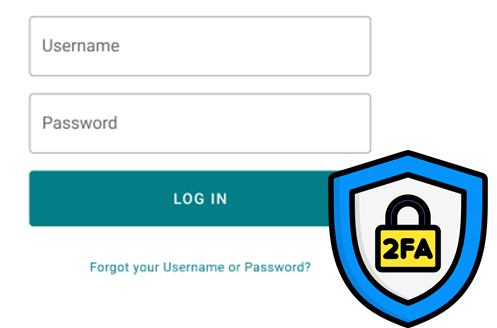
- Enhanced Security: Protects against unauthorized access by ensuring only the rightful user can login.
- User Control: Allows users or admins to decide who needs additional security based on their role or preference.
- Easy Integration: Seamlessly integrates into the existing login process without requiring extensive setup.
Two-Factor Authentication (2FA) has been added to Sentinel v1.5. 2FA enhances data security, ensuring only authorised users can login to the platform. This feature will ensure the safety, reliability, and integrity of the data.
Integrated Weather
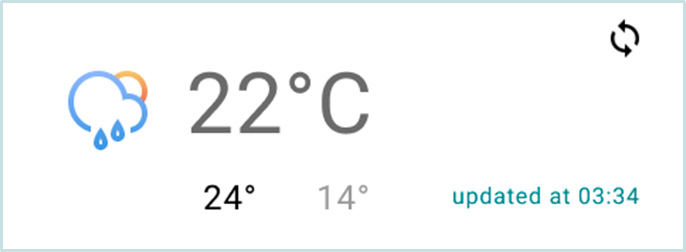
- Current temperature: Stay informed about the temperature in your mining site right now.
- Max & Min: know the day’s expected temperature range.
- Precipitation: don’t worry if you haven’t collected your past precipitation stats, we’ll do it for you.
- Cross-check: your own terrestrial weather station data with our external provider.
Live weather updates have been added to Sentinel v1.5. This address the addresses a common challenge of maintaining accurate weather data, especially rainfall, during non-working days or anomalous weather events.
A secondary source of weather data will allow mine operators to verify their collected data, ensuring accuracy.
OpenStreetMap
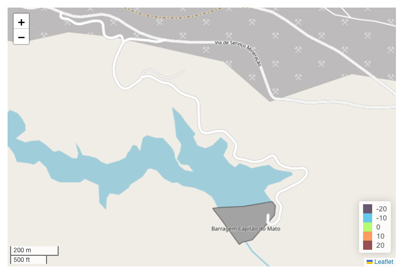
- Seamlessly Toggle Views: Easily switch between detailed OSM maps and high-resolution Sentinel-1 satellite imagery.
- Enhanced Location Insights: Gain comprehensive insights into any area of interest with both street maps and satellite views.
- Richer Geographic Context: Combine the strengths of OSM's detailed mapping with Sentinel-1's satellite imagery for a fuller understanding of any location.
- User-Friendly Navigation: Intuitive interface design makes it easy for users to switch views and access the information they need.
OpenStreetMap (OSM) is now integrated with Sentinel, providing rich geographical data in addition to satellite imagery. The OSM view complements Sentinel-2 satellite images. It provides an alternative perspective revealing details missed by satellites, ensuring operators access the most accurate geographical information.
This dual-view approach is particularly useful where operators need to delineate the precise boundaries of smaller or more complex sites, which can be challenging with standard satellite imagery alone.
AI and IoT insights to help you transform your business


Copyright © Davra Networks 2026. All rights reserved.
Cookie & Privacy Policy